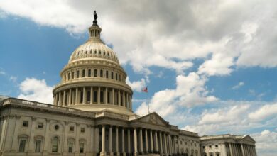
Supreme Court Gerrymandering Decision Could Redraw Congressional Maps in Swing States
The Supreme Court’s recent silence on gerrymandering challenges has created a power vacuum that state courts are rushing to fill, potentially triggering the most significant redistricting wave since the 1960s. With congressional maps in Pennsylvania, North Carolina, and Wisconsin already under legal siege, the 2024 elections could be decided by judges rather than voters.
The high court’s decision to let lower court rulings stand marks a dramatic shift from its previous hands-off approach to partisan gerrymandering. While the justices declared federal courts couldn’t intervene in political map-drawing in 2019, state supreme courts have proven far more willing to strike down districts they deem unconstitutional under state law.
State Courts Take the Lead on Redistricting Battles
Pennsylvania’s Supreme Court has emerged as the most aggressive watchdog against gerrymandered maps. The court’s Democratic majority struck down the state’s congressional districts in 2018, leading to a court-drawn map that flipped four House seats from Republican to Democratic control. Now, with new census data and shifting population centers, Pennsylvania faces another potential redraw that could affect three to four competitive districts.
North Carolina presents an even more complex battleground. The state’s Supreme Court initially approved Republican-drawn maps in 2022, but a newly configured court with a different partisan makeup has signaled willingness to revisit those decisions. Legal challenges are already pending that could force lawmakers back to the drawing board before the next redistricting cycle.
Wisconsin’s gerrymandering saga has stretched across multiple election cycles. The state’s Democratic governor and Republican legislature remain deadlocked over fair mapping, while federal courts have intervened sporadically. The Wisconsin Supreme Court’s recent shift to a liberal majority has emboldened redistricting advocates to pursue more aggressive challenges to the current maps.
Swing State Mathematics: Where Every District Counts
The potential redistricting wave carries enormous implications for House control. Political analysts estimate that fairer maps in just five swing states could flip between eight and twelve congressional seats, enough to determine which party controls the chamber.
Michigan has already demonstrated this dynamic in action. After voters approved an independent redistricting commission in 2018, the state’s congressional delegation shifted from heavily Republican to nearly even split. The commission’s work eliminated several safe GOP seats while creating new competitive districts that Democrats successfully contested in 2022.
Arizona’s independent commission faced similar pressures but reached different conclusions. Despite legal challenges from both parties, the commission’s maps have largely withstood court scrutiny. However, rapid population growth in Phoenix and Tucson suburbs could force significant changes in the next redistricting cycle, potentially affecting two Republican-held seats.

Florida represents the opposite extreme, where Republican control of state government has produced maps that maximized partisan advantage. The state’s Supreme Court, now dominated by conservative justices, has shown little appetite for challenging the legislature’s work. This divergence highlights how state-level politics directly influence redistricting outcomes.
Legal Precedents Shape Future Map Challenges
State constitutional provisions vary dramatically in their approach to redistricting requirements. Some states explicitly prohibit partisan gerrymandering, while others focus on traditional criteria like compactness and keeping communities together. These differences create a patchwork of legal standards that advocacy groups are learning to navigate.
The Pennsylvania Constitution’s requirement for districts to be “compact and contiguous” has provided courts with clear standards for rejecting maps. Similarly, North Carolina’s constitution prohibits districts designed to “deny or abridge the equal opportunity of all citizens to participate in the political process.” These specific provisions give judges concrete legal grounds for intervention.
New York’s experience illustrates the challenges even reform-minded states face. Despite creating an independent redistricting commission, the state’s legislature ultimately drew its own maps after rejecting the commission’s work. Courts later struck down those legislative maps, leading to a special master drawing the final districts used in 2022.
The Congressional Term Limits Movement Gains Momentum Across Red States reflects similar grassroots frustration with incumbent protection, though through different constitutional mechanisms. Both movements share concerns about representative democracy and fair electoral competition.
Technology and Transparency Transform Map-Making
Modern redistricting occurs in a vastly different technological landscape than previous decades. Sophisticated mapping software allows precise population counts down to individual city blocks, while big data analytics can predict voting patterns with unprecedented accuracy. These tools have made gerrymandering both more precise and more detectable.
Public access to redistricting data has democratized map analysis. Advocacy groups now routinely produce alternative maps and statistical analyses challenging official district boundaries. This transparency has strengthened legal challenges by providing courts with concrete alternatives to disputed maps.
Social media platforms have amplified redistricting debates, allowing citizens to share information about map proposals and organize opposition campaigns. This grassroots engagement has made redistricting more politically visible, increasing pressure on lawmakers to justify their choices publicly.
Looking Ahead: The 2030 Census and Beyond
The next major redistricting opportunity won’t arrive until after the 2030 census, but demographic trends are already shaping future battles. Suburban growth in traditionally Republican areas could force map-makers to account for changing voter preferences, while urban population shifts may require significant boundary adjustments.
Climate change could introduce unexpected variables into redistricting calculations. Coastal districts may need adjustment due to sea level rise, while internal migration patterns could shift population centers in unpredictable ways. These factors add uncertainty to long-term political planning.
The Supreme Court’s evolving composition may also influence future redistricting decisions. While the current court has avoided federal intervention in partisan gerrymandering cases, different circumstances or legal theories could prompt renewed engagement with these issues.
State-level political changes remain the most immediate factor affecting redistricting outcomes. Governor races and state legislative elections directly impact who draws the maps, making these contests increasingly important for national political strategy.
The current gerrymandering battles represent more than technical legal disputes over district boundaries. They reflect fundamental questions about representative democracy, partisan fairness, and the balance between state and federal authority in electoral matters. As courts continue reshaping congressional maps across swing states, the outcomes will determine not just which party controls Congress, but how Americans understand the relationship between their votes and their representation.
Frequently Asked Questions
How many congressional seats could change due to redistricting?
Political analysts estimate 8-12 House seats across five swing states could flip due to fairer redistricting maps.
Which states are most likely to see redrawn maps?
Pennsylvania, North Carolina, Wisconsin, and Michigan face the most active redistricting challenges in state courts.