Mortgage Lenders Are Requiring Climate Risk Assessments for Coastal Properties

Major lenders across the United States are now requiring detailed climate risk assessments before approving mortgages on coastal properties, marking a shift in how the financial industry evaluates real estate investments in flood-prone areas.

Banks Implement New Risk Evaluation Standards
The new requirements typically involve third-party assessments that analyze flood projections, storm surge models, and sea level rise estimates specific to each property location. Borrowers must provide documentation showing how their property stands up to various climate scenarios over the next 30 years – the typical length of a mortgage term.
Major financial institutions have quietly rolled out these policies over the past 18 months, with some requiring the assessments for properties within five miles of any coastline. The evaluations can cost homebuyers between $500 and $2,000, depending on the property’s location and complexity of the analysis required.
Lenders point to mounting insurance losses and federal flood insurance changes as driving factors behind the policy shift. Properties that receive poor climate risk ratings may face higher interest rates, larger down payment requirements, or outright loan denials.
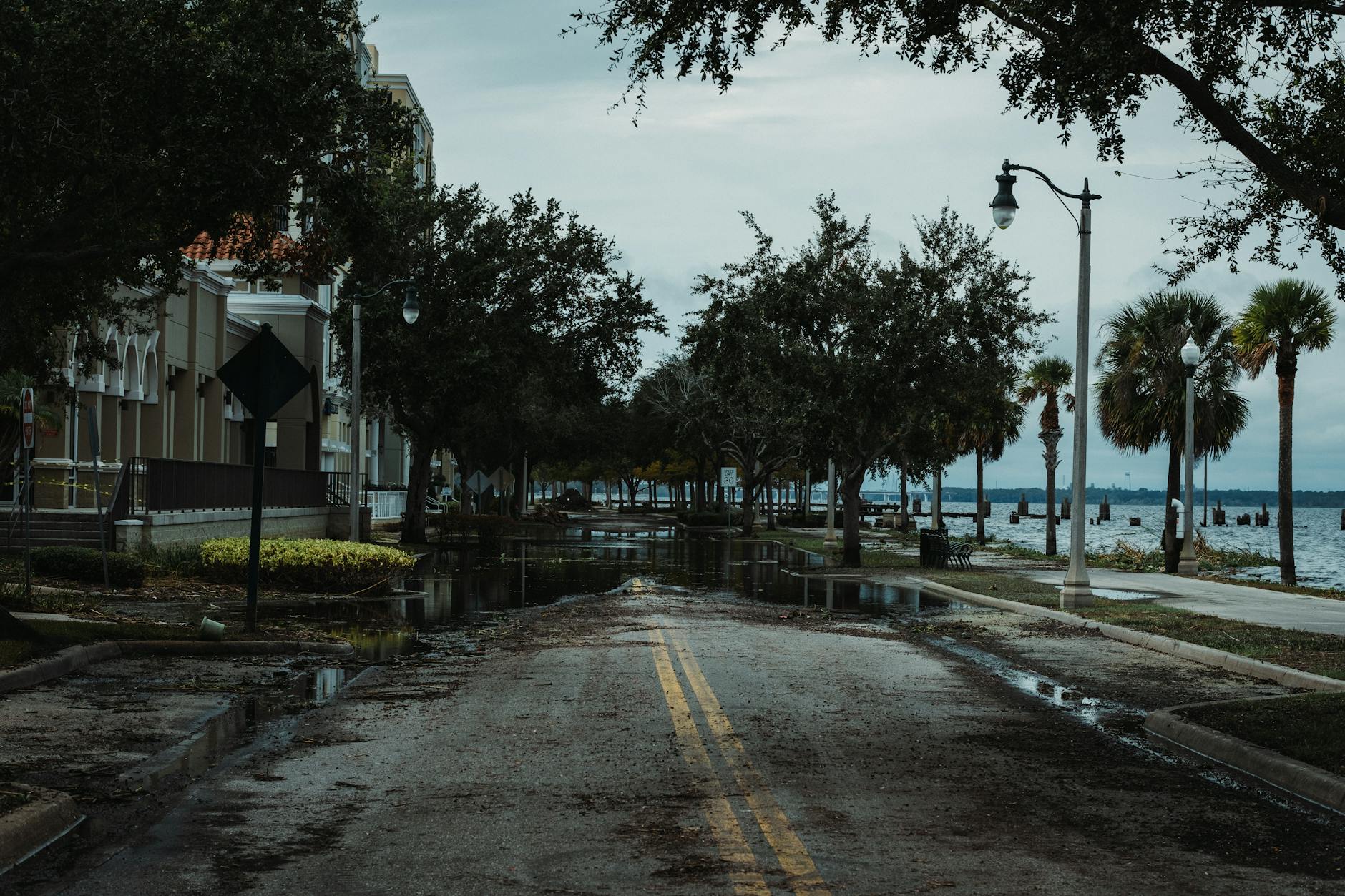
The assessments examine factors beyond traditional flood zone maps, including erosion rates, infrastructure vulnerability, and local government adaptation plans. This comprehensive approach often reveals risks that standard flood insurance evaluations miss, particularly for properties that currently sit outside designated flood zones but may face future threats.
Impact on Property Values and Market Dynamics
Properties receiving unfavorable climate assessments are seeing immediate effects on their marketability. Some sellers have experienced extended listing periods, while others have been forced to reduce asking prices to compensate for newly identified risks.
Real estate agents report that buyers are increasingly requesting climate risk information before making offers, even in areas not traditionally considered high-risk. This shift has created a two-tiered market where properties with favorable assessments command premium prices, while those with concerning projections struggle to find buyers willing to meet asking prices.

The assessments often reveal surprising vulnerabilities in properties that appeared safe under traditional evaluation methods. Homes built on fill dirt, properties with aging seawalls, or areas dependent on storm water systems that haven’t been updated in decades frequently receive poor ratings despite their current condition.
Mortgage brokers describe a learning curve as both lenders and borrowers adapt to the new requirements. Some loan applications that would have sailed through approval just two years ago now face weeks of additional review while climate assessments are completed and analyzed.
The ripple effects extend to property insurance markets, where insurers are using similar data to adjust coverage terms and pricing. Properties that fail to meet certain climate resilience standards may find themselves unable to secure adequate coverage at affordable rates, creating additional barriers to financing.
Regional Variations and Future Implications
Different coastal regions face varying levels of scrutiny based on local climate projections and historical weather patterns. Properties along the Gulf Coast and South Florida face the most stringent requirements, while some Pacific Coast areas with different risk profiles see more moderate assessment standards.
The mortgage industry’s embrace of climate risk evaluation represents a fundamental change in how real estate value gets calculated. Properties that have maintained stable values for decades may find their worth questioned as lenders factor in risks that extend far beyond current market conditions.